
 Izdanje Srbija
 Serbische Ausgabe
 Izdanje BiH
 Izdanje Crna Gora


 News
News


(NOMINATION FOR AUREA 2017 AWARD): AgriSens - Software for data analysis from agricultural areas
 Tuesday, 21.03.2017.
14:13
Tuesday, 21.03.2017.
14:13

Belgrade-based company Logit Solutions has developed a unique technological platform called AgriSens, performing agricultural area survey processing and data analysis, based on a variety of information techniques (Machine Learning, Data Science and Computer Vision). The surveying of agricultural areas is performed by drones or other aircraft (airplanes, satellites), and the images are then processed by the software, providing farmers with concrete, concise and usable important information. This way, AgriSens enables agriculturists to review the quality of the sowing and the plantations, the expected yields, areas under risk of plant stress etc, with minimal expenses and without requiring the skills of handling modern technology.
Logit Solutions is only one of the 5 companies in the world developing this type of software. The AgriSens platform has been developed for the past two years, and the commercialization of the software started in the spring of 2016. In under a year, 800 users in over 30 countries throughout the world have started using AgriSens.
The technology has been fully developed by the engineers of the Belgrade company (local know-how) in cooperation with experts from the University of Belgrade and associates from the fields of agronomy, statistics and electrical engineering. The company has thereby contributed to raising awareness of the importance of implementing IT solutions in agriculture.
A part of the development funds has been secured by the European fund FRACTALS as an incentive to the development of innovative technological solutions in agriculture, whereas the remaining part has been invested organically, from their own funds.
The target group consists primarily of agricultural producers, for enhancing the production and reducing expenses and risks, insurance companies, in damage and premium assessment, seed producers and researchers in the field of agriculture, but also the public sector in the various regulatory areas, for supervision and planning within the agricultural sector.
INNOVATION

Since May 2016, AgriSens has been a partner of the American company DroneDeploy, the world leader in the field of navigation and survey processing software development. Together, they are developing a platform which should act as a kind of an operating system for controlling drones and processing the gathered images.
The system operates as follows. Each drone is powered by a piece of controlling software, which provides the aircraft with basic flight functionality. The DroneDeploy software is installed and the AgriSens app is downloaded. The DroneDeploy software provides the possibility of marking the field, that is, of mapping the parcel in question, calculating the best flight course and then combining the images made by the drone into a single simplified photograph (everything is performed within a cloud). The simplified photograph (tiff image), which can take the form of a 2D or a 3D model, is further analyzed by the AgriSens software, providing farmers with concrete, concise and usable information important to agricultural production.
The user gets the analysis of the surveyed area in the form of a PDF report, providing three basic types of information: plant counting, plant estimating and stress monitoring. This way, AgriSens enables agriculturists to review the quality of the sowing and the plantations, the expected yields, areas under risk of plant stress etc, with minimal expenses and without requiring the skills of handling modern technology. Insurance is a special aspect – the software estimates the yields, based on which a risk assessment is performed (fewer than 10% of agricultural areas are insured in Serbia).
AgriSens is a constantly upgraded database. More users means more data being processed, which leads to the program becoming better (applied statistics and informatics). At the same time, the data remain in the database and can be used for further innovations in the sense of providing new services to users – business intelligence etc.
Strategic cooperation with DroneDeploy is the business model which Logit Soultions has opted for since it is the most frequent platform for processing images made by drones in the world and since drones are the most economic solution for user-oriented field surveying. A drone can process between 100 and 200 hectares of land a day, practically without cost, whereas an hour of surveying by helicopter or airplane is very expensive.
Thanks to its AgriSens technology, Logit Solutions has placed on the 2016 world map of drone solutions made by the Drone Industry Insights portal, as one of only five companies developing this kind of software in the whole world. The agricultural solution has thereby put the Serbian company side by side with renowned French, Canadian, British and American software companies developing agribusiness apps. Furthermore, DroneDeploy opened its online store on November 4, and AgriSens is one of only 15 companies to have been invited as a starting partner on the occasion of putting the American company's App Market Store into operation.
Cooperation with DroneDeploy, however, is only one of the ways of using the AgriSens software. Land survey can be performed by airplane or helicopter, and satellite images can be used as well. Users only need to upload them as tiff images to the AgriSens site to be processed, along with providing some basic bits of information (the culture in question, the standard the user is aiming for). Downloading AgriSens is all it takes to become a user.
Logit Solutions also offers the option of renting their drone.
SOCIAL
USEFULNESS

The idea of developing AgriSense itself initially emerged as a result of following global scientific and technological trends, and the field is known as Precision Agriculture. Utilizing the potentials of technology and the end results provided to farmers, as well as the possibility of implementation in practice, is increasingly coming into focus as the missing link.
By developing AgriSens, Logit Solutions has contributed to further raising the awareness of the importance of implementing IT solutions in agriculture, promoting not just the technology itself, as something new and popular, but also its implementation, usefulness and practical benefits and values it brings to its users, agricultural producers.
Thanks to this, Logit Solutions and its AgriSens technology were featured in DroneDeploy's August report on current trends in commercial utilization of drones. Namely, in the section dealing with the implementation of unmanned aerial vehicles in agriculture, the case of a Japanese agri-consultant working for a private company in North California is cited as an example of good practice.
With the help of AgriSens and Precision Agriculture, he managed to count close to 450,000 tomato stems, sown by a third company. He thereby determined a discrepancy between 5% of losses, reported by the partner company, and the real 26% shown by precision counting. In order to do this, he needed a drone, which flew over the entire area in around 30 minutes, whereas manual counting would take a day or two, and with considerably reduced precision.
Considering that this is a business in which one pays only for what one sees in the field, the implementation of AgriSens, which gathered and processed the data and counted the stems, enabled the agriculturist and his adviser to hold the company in charge of sowing tomatoes responsible, thereby avoiding incurring unplanned losses.
The software developed by Logit Solutions is built entirely on local know-how, and the technology was being developed continuously, with up to 20 experts working on the project at certain points. Aside from IT experts, associates from the fields of agronomy, statistics, electrical engineering, but also sales and marketing, were employed in order to create a sustainable business model. On average, 10 experts were continuously employed on developing the technology.
The business model implemented by Logit Solutions, gathering UAV images, also features an environmental dimension, since the utilization of battery-powered drones for surveying agricultural areas doesn't pollute the environment. Furthermore, the implementation of the results of the analysis provided by AgriSens enables precise usage of pesticides and herbicides, avoiding excess usage, since it provides useful information as to when the plants truly require treatment by chemicals.
FINANCIAL
POTENTIAL

Logit Solutions says that they are satisfied with the interest displayed and that the revenues are mostly coming from abroad for now. Most of their users come from the United States of America, Central America and the states of the Western Europe. The American company CNH Industrial, the biggest producer of agricultural mechanization in the world, has also signed an agreement with DroneDeploy on the sale of DroneDeploy software, along with the AgriSens app, to agricultural producers on a global level, which will further contribute to an increase in the number of users.
UAV surveying and its utilization in agriculture is only just developing, and the estimate is that, by 2020, there will be 10 times more drones used commercially than airplanes. Due to the industry's boom, requirements for drone management have been considerably loosened in America since August 29, 2016. Instead of a pilot's license, a simplified license is now sufficient for UAV control.
Serbia is also showing increasingly more interest in the AgriSens software. A special business model is being developed for this market and this region, and the primary target group will consist of individual producers and big agricultural companies.
AgriSens is still in the development stage and several hundred thousand euros have been invested in it so far. Part of it has been secured from the EU funds, as incentives to the development on innovative technological solutions in agriculture within the FRACTALS (Future Internet Enabled Agricultural Applications, FP7 project No. 632874) project, whereas the rest has been invested organically, from their own funds.
Each new user further expands the knowledge base, provides new information and contributes to refining the software. The main group no doubt consists of agricultural producers, for enhancing the production and reducing expenses and risks, insurance companies, in damage and premium assessment, seed producers and researchers in the field of agriculture, but also the public sector in the various regulatory areas, for supervision and planning within the agricultural sector.
The plan is to also develop new ways of software implementation in line with user demand: in construction, energy efficiency, ecology (landfill surveying). The possibilities are enormous, and the company is competent and has the know-how necessary to use them.
If AgriSens software for data analysis from agricultural areas is your favorite one for the investment of the year, you can vote at the official website of Aurea award.
Most Important News
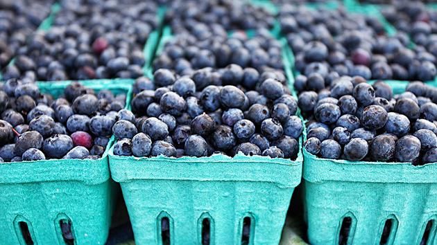
06.04.2024. | Agriculture
Preconditions for Placement of Fresh Blueberries and Dried Plums in Chinese Market Secured
16.04.2024. | News
Jovan Ciric, Leasing Director Retail MPC Properties – MPC Echo symbolizes our desire for good ideas and innovative endeavors to spread freely and bring about positive changes

16.04.2024. | News
10.04.2024. | Finance, IT, Telecommunications, Tourism, Sports, Culture
Creative Industry – What This Serbian Economy Sector Worth EUR 2 Billion Encompasses

10.04.2024. | Finance, IT, Telecommunications, Tourism, Sports, Culture
18.04.2024. | Industry, Finance
Here come the new hunters for Serbian gold – Australian Strickland Metals buys mining project on mountain Rogozna

18.04.2024. | Industry, Finance
16.04.2024. | News
Economy Fair in Mostar opens – 26 companies from Serbia exhibiting
16.04.2024. | News
18.04.2024. | Transport
Jovanovic: Purchase of Siemens trams produced in Kragujevac for GSP Beograd should be considered
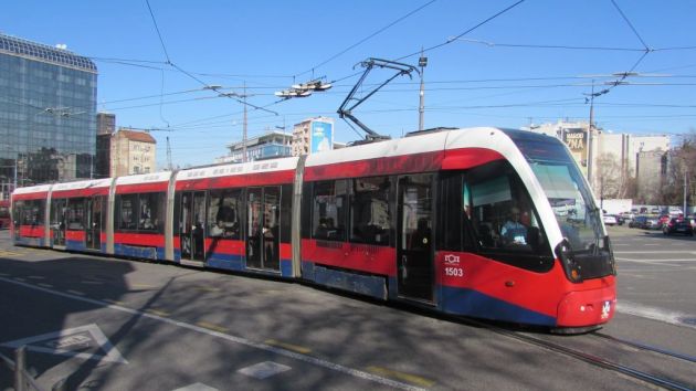
18.04.2024. | Transport